Translate

8/24/19

Billings Montana


 Crow Indians Settlers Oil Discovery Microbreweries and a Heritage Trail

Billings is the largest city in Montana and is located in the south-central portion of the state. With the Bakken oil development in eastern Montana and western North Dakota, the largest oil discovery in U.S. history, as well as the Heath shale oil discovery, the city's growth rate stayed high during the shale oil boom. Nicknamed the Magic City because of its rapid growth from its founding as a railroad town in March 1882. It is named for Frederick H. Billings. Billings is the trade and distribution center for much of Montana east of the Continental Divide, Northern Wyoming, and western portions of North and South Dakota. Billings is also the retail destination for much of the same area. With more hotel accommodations than any area within a five-state region, the city hosts a variety of conventions, concerts, sporting events, and other rallies.
The downtown area and much of the rest of Billings is in the Yellowstone Valley which is a canyon carved out by the Yellowstone River.
The Crow Indians have called the Billings area home since about 1700
Settlers from the Gallatin Valley area of the Montana Territory formed Coulson the first town of the Yellowstone Valley. The town was started when John Alderson built a sawmill and convinced PW McAdow to open a general store and trading post on land that Alderson owned on the bank of the Yellowstone River. Before the railroad, most goods coming to and going from the Montana Territory were carried on paddle riverboats. When the railroad came to the area, they established the new town of Billings; for a short-time the two towns were linked with a trolley service.
Coulson was a rough town of dance halls and saloons and not a single church
Downtown Billings is a blend of small businesses and office space, together with restaurants and a walkable brewery district. With eight microbreweries, Billings has more breweries than any community in Montana. Downtown Billings also has a distillery that makes a variety of handcrafted spirits. Babcock Theater is a 750-seat performing arts theater built in 1907 and at the time was considered the largest theater between Minneapolis and Seattle.    
Neighborhoods are at the heart of Billings. The south side is probably the oldest residential area in the city, and it is the most culturally diverse neighborhood. South Park is an old growth City park, host to several food fairs and festivals in the summer months. The Bottom Westend Historic District is home to many of Billings first mansions. Midtown is undergoing gentrification and new growth is mainly concentrated on the West End.
MET Transit provides fixed-route and para transit bus service. All MET buses are accessible by citizens who use wheelchairs and other mobility devices. They are wheelchair lift-equipped and accessible to all citizens who are unable to use the stairs. MET buses are equipped with bike racks for their bike-riding passengers.

The Heritage Trail System has well-maintained trails and pathways

Around Billings, there are seven mountain ranges, including the Bighorn and Pryor Mountains, home the Pryor Mountain Wild Horse Range.

Cape Girardeau Missouri


river trade steamboats trading posts bridges murals and historic sites
Cape Girardeau is named after Jean Baptiste de Girardot, who established a trading post in the area around 1733. As early as 1765, a bend in the Mississippi River, had been referred to as Cape Girardot or Girardeau.  In 1799, American settlers founded the first English school west of the Mississippi at a landmark called Mount Tabor, named by the settlers for the Biblical Mount Tabor.
The River Trade and Steamboats stimulated the Development of Cape Girardeau
City Landmarks in 1928, a bridge was completed between Missouri and Illinois replacing ferries to cross the Mississippi River. In 2003, the Old Bridge was succeeded by a new four-lane cable-stay bridge named the Bill Emerson Memorial Bridge; the two towers of the bridge reach a height of approximately 91 meters The Old Federal Courthouse, located at Broadway and Fountain Streets and built in the late 1940s, The City of Cape Girardeau was recognized in 2008 as a Preserve America Community for its work in surveying and protecting historic buildings.; it is home to 39 historic sites and eight historic districts, including the Downtown Commercial District.
The Mississippi River Tales is a mural containing 24 panels covering nearly 18,000 square feet (1,700 m2) of the 15-foot (4.6 m)-high downtown floodwall; they illustrate the local history beginning with the Native Americans who inhabited the area between 900 and 1200; each panel tells a story. The paintings are reminiscent of the works by Thomas Hart Benton; they were painted by Chicago artist Thomas Melvin in collaboration with several local artists.

8/22/19

North Platte Nebraska


railroad town river trails historical museum and buffalo bill ranch park
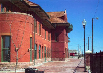
North Platte is in southwestern Nebraska at the confluence of the North and South Platte Rivers. It was established in 1868 when the Union Pacific Railroad was extended to that point; it was named from the North Platte River.
The Platte River originates in the state of Nebraska and is about 310 miles - 500 km - long. The Platte is a tributary of the Missouri and Mississippi Rivers which flows to the Gulf of Mexico.
River Valley Trails played an important role in the westward expansion of the United States, providing the route for several major emigrant trails, including the Oregon, California, Mormon and Bozeman Trails. The French were the first Europeans to reach the Platte. The North Platte River is navigable over most of its length at high water by canoes, kayaks and rafts.
Bailey Yard is the world’s largest. The Golden Spike Tower and Visitor Center is an eight-story building which overlooks the expansive classification yard and engine facilities.
The Lincoln County Historical Museum contains a display detailing the history of the North Platte Canteen, which greeted 6.5 million service personnel from Christmas Day 1941 through April 1, 1946. It also contains a Prairie Village with local landmark homes and a Pony Express station and pioneer church.
Buffalo Bill Ranch State Historical Park is located near here, a Nebraska living history park about Buffalo Bill Cody. The park includes his actual house known as Scout's Rest Ranch.

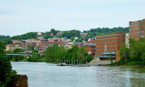
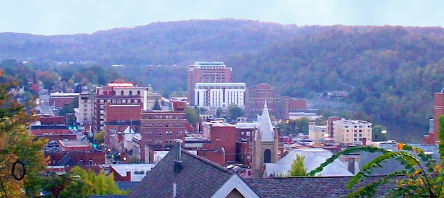
Morgantown West Virginia


historic neighborhoods industry river shipping and personal rapid transit
Morgantown is located just south of the Mason-Dixon Line, 75 miles (121 km) south of Pittsburgh, 208 mi (335 km) north-northwest of Washington, D.C., 204 mi (328 km) east of Columbus and 156 miles (251 km) northeast of Charleston, WV.  
The History of Morgantown is closely tied to the Anglo-French struggle for this territory. Until the Treaty of Paris in 1763, the area was greatly contested by white settlers and Native Americans, and by British and French soldiers. Several forts were built during this time, including Fort Morgan in 1772 when Zackquill Morgan established a homestead near present-day Fayette Street and University Avenue.
The city is comprised of several neighborhoods that were once independent towns, including: First Ward, Woodburn, South Park, Jerome Park, South Hills, Second Ward, Greenmont, Suncrest, Evansdale, Wiles Hill, Sunnyside, Sabraton, the Mileground, and North Hills. While some of these are in part or entirely outside the city limits, they are still considered part of Morgantown as trolley cars determined how far people lived outside of the city.
Development of the DuPont Ordnance Works during World War II resulted in prefabricated homes being constructed in Suncrest, the names of some streets reflected the community's participation in various service organizations, such as Civitan, Kiwanis, Lions and Rotary.
In 2000, the White House Millennium Council designated Suncrest as a Millennium Community
South Park is across Deckers Creek from downtown Morgantown. Originally farmland, it was one of the first suburbs of Morgantown. In the early 20th century, South Park experienced a housing boom, with wealthy and influential citizens settling there. The neighborhood is designated a historic district by the National Register of Historic Places.
Following World War II, many new families came to Woodburn, attracted by the parkland, closeness to downtown, community atmosphere, and nearby school. In 1950, Tom and Anna Torch opened the Richwood Avenue Confectionery, a corner store and lunch counter that served beer in large Weiss goblets from the Morgantown Glassworks. When they sold the operation in 1963 to Mario and Rose Spina, the establishment was nicknamed Mario’s Fishbowl in honor of the goblets.
Transportation Morgantown relies heavily on the Monongahela River for shipping coal and other products. The river is fully navigable from its mouth at the Ohio River in Pittsburgh, past Morgantown upstream to Fairmont Morgantown Lock and Dam, located in the southern part of the city.
Transit Morgantown Personal Rapid Transit PRT most of Morgantown is accessible by the Mountain Line Transit Authority bus system. The Morgantown Personal Rapid Transit PRT system covers 8.65 miles (13.9 km) and has five stations.

8/20/19

Des Moines Iowa


pre-historic native Americans skyscrapers skywalks museums and botanical gardens
Des Moines traces its origins to May 1843 with the construction of a fort on the site where the Des Moines and Raccoon Rivers merge. The fort was built to control the Sauk and Meskwaki Indians, whom the government had moved to the area from their traditional lands in eastern Iowa.
Native American Tribes did not fare well as the illegal whiskey trade and the destruction of traditional life led to severe problems for their society. At least three Late Prehistoric villages, dating from about AD 1300 to 1700, stood in or near what developed later as downtown Des Moines. In addition, 15 to 18 prehistoric American Indian mounds were observed in this area by early settlers. All have been destroyed during development of the city.
Archaeological Excavations have shown many fort-related structures; soldiers stationed at Fort Des Moines opened the first coal mines in the area, mining coal from the riverbank for the fort's blacksmith.
Present Day Des Moines changed from the 1970s to the1990s, as several new skyscrapers were built. In the 21st century, the city has had more major construction in the downtown area. The Principal Riverwalk features trails, pedestrian bridges across the river, a fountain and skating plaza, and a civic garden in front of the City Hall. Existing downtown buildings were converted to loft apartments.


A Cultural Center with Several Art and History Museums as well as Performing Arts Groups
The Metro Opera House has been a cultural resource in Des Moines since 1973. The Opera offers educational and outreach programs and is one of the largest performing arts organizations in the state. 
The Des Moines Art Center presents art exhibitions and educational programs as well as studio art classes. The Center houses a collection from the 19th century to the present. An extension of the art center is downtown in an urban museum space, featuring several exhibitions a year.


The Pappajohn Sculpture Park is a collection of 24 Sculptures
The Greater Des Moines Botanical Garden is an indoor conservatory of over 15,000 exotic plants. Developed by the city's Asian community, the Gardens include a three-story Chinese pavilion, bonsai landscaping, and granite sculptures that highlight the importance of diversity and recognize Asian American contributions in Iowa.
The East Village begins at the river and extends about five blocks east to the State Capitol Building, offering a blend of historic buildings, eateries, boutiques, art galleries, and a wide variety of retail establishments and residences.
Transportation Des Moines has an extensive skywalk system within its downtown core. With over four miles of enclosed walkway, it is one of the largest of such systems in the United States. The public transit system consists entirely of buses, including regular in-city routes and express and commuter buses to outlying suburban areas.

8/19/19

Dodge City Kansas

frontier town gunfights saloons cows and western trails
History Fort Mann was the first settlement of non-indigenous people in the area that became Dodge City. It was built by civilians in 1847 to provide protection for travelers on the Santa Fe Trail. In 1865, the army constructed Fort Dodge which remained in operation until 1882. The town of Dodge City can trace its origins to 1871, when rancher Henry J. Sitler built a sod house west of Fort Dodge to oversee his cattle operations located near the Santa Fe Trail and the Arkansas River.

Dodge City was staked out in 1872 on the 100th meridian and the legal western boundary of the Fort Dodge reservation. The early settlers traded in buffalo bones and hides; with the arrival of the railroad, Dodge City soon became involved in the cattle trade. The queen of the cow towns resulted from the new Western Trail that branched off from the Chisholm Trail.


Frontier town Dodge City had more gunfighters working at one time or another than any other town in the West as well as saloons, gambling halls, and brothels, led by the Long Branch Saloon and the China Doll brothel. By 1886, the cowboys, saloon keepers, gamblers, and brothel owners moved west to greener pastures, and Dodge City became a sleepy little town in western Kansas.


Dodge City sits above one of the world's largest underground water systems
Culture Starting in the 1870s, the early city history fueled public perceptions of frontier turmoil in the public consciousness. Gunfighters and lawmen such as Wyatt Earp became celebrities, and sensationalized versions of their activities entered period popular culture as the subject of dime novels. This trend continued into the 20th century, as the rowdy Old West frontier town was the setting for many films and television series such as Gunsmoke, the longest-running prime-time TV drama in American history. In the Smallville TV series, Clark Kent’s hometown is 200 miles (320 km) west of Wichita and Metropolis is southwest of Dodge City.

Philadelphia and the Delaware River Valley


River Walk and Bike Trails Food Wine Ale and Neighborhood Preservation
The Delaware River Valley is the metropolitan area centered on the city of Philadelphia, the region's major commercial, cultural, and industrial center. Among the many sights to take in when visiting the first capital of the United States: The Liberty Bell Center which houses the American Revolution’s defining symbol, the site of the meetings of Congress and the Constitutional Convention at the City Tavern in the Old City as well as Carpenters Hall. In Declaration House, visitors can see where Thomas Jefferson drafted the Declaration of Independence and Independence Hall where it was signed.

Greater Philadelphia Transportation

The region’s excellent road and rail network make it the perfect location for a vacation or business trip to the Middle Atlantic States. Philadelphia International is a major airline hub with daily connections to North American destinations and from major European cities.


The River and the Environment
The Delaware River is comprised of 36 tributaries and flows 330 miles from New York to Pennsylvania, New Jersey and Delaware to the Atlantic Ocean. It extends from the Catskill and Pocono mountain springs and streams flowing down to the Delaware Water Gap where steep slopes give way to gently rolling hills and sweeping valleys. Then, it stretches 134 miles from the Trenton falls to the mouth of the Delaware Bay read 
 Food Wine Ale Walk and Bike Trails
The Philadelphia Culinary Tradition was shaped by several ethnic groups. Cheese steaks and soft pretzels are well known icons of this city and the 1970s saw a restaurant renaissance that is continuing into the 21st century. Food traditions include Pepper Pot, a soup of tripe, meat and vegetables from the Revolutionary War era and Snapper Soup a thick brown turtle soup served with sherry. Cheesesteaks, hoagies and roast pork sandwiches have helped Philadelphia become America’s sandwich city.


Neighborhood and Community Preservation
Lehigh Valley Historic Towns and Boroughs Allentown Bethlehem Easton Nazareth Hazleton Jim Thorpe Wilkes-Barre. A thriving town with roots in the iron industry, by 1829 Allentown expanded from a small Pennsylvania Dutch village of farmers and tradesmen to a center of commerce.
The Lehigh Valley Gave Birth to America’s Industrial Revolution

Bucks County is one of the three original counties created by William Penn in 1682. Bristol is the oldest town in Bucks County and the third oldest in Pennsylvania. It is the southern terminus of the D&L Trail characterized by coal yards, shipyards, warehouses and textile mills.
Chestnut Hill a beautiful award-winning neighborhood tucked into the northwest corner of Philadelphia. Renowned for its gardens, art and architecture, parks, shopping and dining, it is a lovely place to live or visit with many diverse, culturally enriching experiences.

historic districts preservation and pirates
Delaware County and River Towns Marcus Hook’s historical significance comes from its identity as a maritime town. Originally a Lenape settlement, it became a New Sweden trading post in the 1640s with shipbuilding and fishing as early industries. The Hook was also a haven for pirates in the early 18th century and its market provided a place to sell plundered goods and re-supply for their next voyage.


Wayne Lansdowne Historic Districts the Downtown Wayne district includes approximately 100 properties roughly bounded by Louella Ct., West Ave., and S. Wayne Ave. Amongst the buildings is the Anthony Wayne Theatre designed in Italian Renaissance style and built around 1864 read
Chester County was established by William Penn in 1682, one of the first three counties in Pennsylvania; West Chester is the county seat. Other historic towns include Kennett Square, Oxford and Phoenixville. Each has its own unique agricultural, revolutionary and industrial histories.
New Castle and Wilmington Delaware founded by the Swedes and Finns in 1638, later acquired by the Dutch in 1655 and the British in 1739, Wilmington was the last stop to freedom on the Underground Railroad. Today it offers a rich performing arts scene, great museums. local wineries and breweries.