Translate

9/29/26

River Towns and Neighborhoods on the Ohio and Upper Mississippi


Louisville St. Louis Alton Davenport Galena Red Wing St. Paul
Louisville was founded by George Rogers Clark in 1778 becoming Kentucky’s largest city by 1830. Strategically located at the Falls of the Ohio, Louisville was a major commercial center with river transportation supplemented by the Louisville & Nashville Railroad, chartered in 1850 and operating 1,800 miles by 1920.
A City of Firsts with a Colorful Past
First in the Nation to introduce the secret ballot and adopt zoning and planning measures to control and shape urban growth, the first bridge designed exclusively for motor vehicles to cross the Ohio River, and birthplace of Mary Millicent Miller, the first woman in the United States to receive a steamboat master's license. Famous citizens include President Zachary Taylor, two U.S. Supreme Court Justices, naturalist John James Audubon and boxing legend Muhammad Ali.

Neighborhoods Louisville’s earliest neighborhoods were incorporated river towns each with its own strong sense of neighborhood identity. The area saw an influx of German and Irish immigrants and, with the advent of streetcars, suburban growth. 1890-1930 streetcars marked the era of the beginning of the city’s suburbs combining rural ambiance with urban amenities.


Downtown St. Louis has undergone a myriad of changes and modifications since its days as a garment and shoe manufacturing center. The Loft District is home to major corporations, small businesses, residential lofts, boutiques, galleries, restaurants and nightspots. The neighborhood’s evolution has returned the once proud historic buildings to service.
The Gateway Arch soars 630 feet above downtown St. Louis. America’s tallest man-made monument offers a 30-mile panoramic view of the Mississippi River and the city; it was built to honor President Thomas Jefferson and his vision of a continental United States.
The Central West End is over a century old and full of charming sidewalk cafés, galleries, antique shops, restaurants, boutiques and pubs. Adjacent to the commercial district, it is characterized by tree-lined streets, stately turn-of-the-century homes and the family apartment of playwright Tennessee Williams, setting of his play The Glass Menagerie.
Webster Groves is an enclave filled with century-old homes and a mélange of architectural styles with cultural offerings, cozy restaurants, and boutiques. Over 300 of the community’s homes are listed on the National Register of Historic Places. The neighborhood includes the 1857 Hawken House, built by inventors of the rifle that explorers took to the western frontier, Webster University and the Loretto-Hilton Theatre.
Soulard is the city’s oldest neighborhood. Its historic streets, lined with red brick townhomes, are located five minutes south of the Arch. It is named for Antoine Soulard, a Frenchman who surveyed colonial St. Louis and is home to historic churches, built by St. Louis’ immigrant communities. Soulard marks its French heritage with an annual Mardi Gras fête; revelers also flock to the neighborhood in the fall for Oktoberfest. The Farmers Market has been operating since 1779.
Laclede’s Landing is where 19th century architecture meets 21st century dining and entertainment. The Landing is a collection of historic riverfront warehouses that have been converted into nightclubs and restaurants.
Alton is located 25 Miles north of St. Louis amid the confluence of three navigable rivers, the Mississippi, the Illinois and the Missouri, as a river trading and industrial town whose waterfront features concrete grain silos and railroad tracks for the shipping of grains and produce. Once the site of several brick factories, Alton’s streets are paved in brick along with many commercial buildings located downtown. The Great Rivers Region is accessible from six interstates, an international airport and an Amtrak station.
Historic Trails Alton’s Civil War and Lincoln Legacy Trail features costumed docents at sites throughout the city revealing Alton’s legacy through personal tales along with the Underground Railroad, where runaway slaves were hidden in caves, barns and basements. The Alton Museum of History and Art has special exhibits relating to Alton’s connection to the Civil War era.


Your River Towns and Neighborhoods Itinerary
on the Ohio and
Upper Mississippi


The Quad Cities area consists of Davenport and Bettendorf in Iowa, and Moline, East Moline and Rock Island in Illinois. The region has the excitement of a big city and the hospitality of a small town with award-winning museums and cultural centers, internationally-recognized festivals, beautiful riverfronts and a vibrant nightlife.
Davenport has beautiful riverfront vistas and an active downtown area with the Figge Art and Putnam History Museums and great shopping at the North Park Mall. Bettendorf the Library and adjacent Family Museum provide exciting programs and storytelling. Rock Island is known for its festivals and nightlife with Cajun food and zydeco music. Experience a downtown architectural tour and the Broadway Historic District. Moline is one of the agricultural capitals of the world, home of John Deere. The modern downtown area features great riverfront views and evening entertainment with musicals performed by local actors. East Moline is home to many great events and festivities. Empire Park is right on the Mississippi River, walk along the riverfront trails of The Quarter or visit to the John Deere Harvester Works, one of the world's largest combine factories.
The Galena Historic District Main Street was among the first to require the architectural review of exterior building modifications. Also, zoning restrictions contributed to the prevalence of brick buildings and efforts to improve the existing infrastructure while preserving the character of this neighborhood. Trolley Cars follow parade routes north and south on Main Street and connect shopping to parks and wineries. Main Street in Galena has specialty shops, restaurants and is home to DeSoto House Hotel which opened in 1855 and is the oldest operating hotel in Illinois.
The Galena Historic District is Listed in the National Register of Historic Places
Environment Because of the city's proximity to the Galena River, buildings have been threatened on numerous occasions by flooding. In 2011, over a 12-hour period, Galena received nearly 15 inches of rain and he Galena River rose to more than twice its normal height. A dike and floodgates were built to prevent flooding of the city.
The River Towns of southeast Minnesota are located 60 miles from the Twin Cities. Winona is an arts and cultural center with three major galleries that hold works by Picasso, Van Gogh and Monet that depict lakes, oceans and rivers. The Garvin Heights overlook features panoramic views of the town and Mississippi River Valley. Follow the Minnesota River Valley Scenic Byway to New Ulm and experience Old World German heritage through unique architecture, restaurants and shops selling German imports, from chocolates to cuckoo clocks. A traditional Glockenspiel features figures from the town’s history.
Red Wing was officially incorporated in 1857. Located in the Mississippi River Valley and flanked by rolling bluffs, the town is a leading manufacturer of leather, pottery and Red Wing Shoes. The town is named for the Native American Chief who first met a US Army Officer in 1805. Tucked between bluffs and the river, Red Wing has many historic Victorian properties and farmhouses, including the St James hotel that dates to the 1880s. It overlooks the Mississippi River near the 1904 Amtrak Depot, home to an art gallery and a visitor center.
Minnesota means clear blue water from the Dakota language. Nearly 60 percent of the population lives in the Twin Cities of Minneapolis and Saint Paul, the center of transportation, business, industry, education, government and an internationally renowned arts community. The remainder of the Land of 10,000 Lakes consists of western prairies, forests in the southeast and mining, forestry, and recreation in the North Woods.
The Twin Cities besides the Mississippi river, they are also connected by the Metro Green Line light rail, which runs between Minneapolis’ Target Field and St. Paul’s Union Depot, with more than 20 stops.
Performing Arts Minnesota is home to older stages that have been restored. Fergus Falls built in 1921 as the Orpheus, and later known as the Fergus Theatre, this venue has evolved from vaudeville to film and back to stage performances. The Center for the Arts remodeled and updated the space in 1995, showcasing a variety of live performances.
Summit Brewing in St Paul is a leader of the modern Minnesota craft beer movement with the release of its ever-popular Extra Pale Ale in 1986. Since its launch, the brewery has expanded both its production facility in St. Paul and its brewing horizons, releasing new year-round and limited-run beers that are among the most popular in the Upper Midwest.

9/09/26

Microgrids and Energy-as-a-Service

 Energy as a Service enables the efficient utilization of resources and assets by helping customers modify energy consumption with time-of-use and real-time pricing.

microgrid systems with equipment re-use re-manufacturing and redeployment


A client-centric approach that reduces energy consumption and costs in collaboration with local utilities and service providers. EaaS:

o   requires no money down or investments by the project beneficiaries

o   includes equipment and components life cycle management and after sales services

o   offers local and regional employment opportunities as well as contracting opportunities

o   features environment friendly services

o   utilizes performance-based payment systems and client discounts


Utilities are project(s) participants. Clients own plant and equipment after 5 years

Distributed Generation occurs on a property site when energy is sold to the building occupants; Power Purchase Agreements - PPAs - enable businesses and governments to purchase electricity directly from the generator rather than from the utility. 

PPAs are a legal contract between an electricity generator and a power purchaser


Microgrids
are electric grids that manage energy and ensure reliable delivery. A self-sufficient, energy plant, the microgrid serves a specific geographic area, neighborhood, and community with distributed energy resources - solar, wind, CHP, other - energy storage, as well as electric vehicle charging stations. Interconnected to nearby buildings, the microgrid provides electricity, heating, and cooling.

community-friendly microgrids: a cheaper alternative in infrastructure development


As-a-Service Models
work particularly well for capital-intensive energy projects; EaaS shifts long-term capital expenditures into a short-term operational expense.

EaaS secures microgrid benefits without risk. The microgrid can serve as the primary source of electrical power, as the emergency backup source of power in the event of a grid outage as it captures reduced energy consumption and utility bills, and sells surplus electricity to the local grid operator. 


9/04/26

Build Operate and Transfer Projects


Travel and Mobility Services, Energy Efficiency and Water Conservation
The Concept a program anchored in communities with a history as hub cities, hence a reliance on connections and collaborations within and among regions, resulting in a national trading platform with economies of scale utilizing historic trade routes and state of the art products and services to the benefit of community commuters, residents and visitors.
The Objective achieve economies of scale pricing in selected communities around the US in the areas of travel, destination management, transit, energy efficiency and water conservation.
Ways and Means a build operate and transfer project, unique to each community but connecting participating towns via customer sharing, transit programs, energy management and similar measures.
Participants a team of product and services providers who provide know-how and resources to jump-start projects in collaboration with local partners.
The BOT is established for a set duration, renewable - with transfer to local partners, inclusive of training for local individuals, existing businesses, local government and nonprofits, where applicable.
Client Targets: US and International Vacationers, Business Travelers and Commuters
Connecting major air and rail metro hubs with micropolitan communities via
Intercity Multi modal and Local Micro Transit hub and spoke services to
Leverage travel client relationships and engage local product and service providers in:

travel   transportation   energy efficiency   water conservation and manufacturing services
Creating Local Virtual Hotels Increasing Productivity and Improving Customer Service.

Developing Deploying Managing and Marketing Systems and Tools that
Benefit Your Community

9/02/26

Coastal Lake and River Trails

Historic Cultural and Culinary Traditions along America’s Waterways
There are many points of interest in the United States; we have selected anchor locations from which you can best base your travel movements, mindful that you are likely to visit three to four places in a compressed period of time, typically 7 to 10 days, and experience multiple interests that range from cultural to culinary, wellness and the environment.

Northeast Atlantic
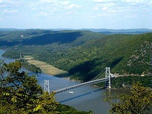
The Hudson Valley extends 150 miles above the tip of Manhattan. Designated as a National Heritage Area, the valley is steeped in history, natural beauty, culture, food and farmers’ markets.
The Delaware rises in two branches and flows 419 miles – 674 Km – into Delaware Bay. Its watershed drains an area of 14,119 square miles - 36,570 km2 - in the five Atlantic Coast States of New York, Pennsylvania, New Jersey, Delaware and Maryland. 
The Hudson and the Delaware were originally called the North and South Rivers
The Susquehanna River is 464 miles (747 km) long and is the longest river on the US East Coast. With its watershed, it is the 16th-largest river in the United States, and the longest river in the continental United States without commercial boat traffic today. In the Canal Era, navigation improvements were made to enhance the river for barge shipping by water on the Pennsylvania Canal.
The Lower Potomac, Anacostia, Patuxent and Wicomico rivers are among the major waterways in the region, but hundreds of smaller streams, creeks and rivers abound providing numerous opportunities for recreational boating.


Mid America
The Upper Mississippi is the portion of the river from Lake Itasca, Minnesota to Cairo, Illinois - 2000 km (1250 mi) where it joins the Ohio River. In terms of geology and hydrography, the Upper Mississippi River valley likely originated as an ice-marginal stream during the Nebraskan glaciation.
The Missouri is the longest river in North America, rising in the Rocky Mountains and flowing east and south for 2,341 miles - 3,767 km - before connecting with the Mississippi north of St. Louis.
The First Westward leg of the Pony Express was a Ferry across the Missouri River
American South
The Lower Mississippi River flows downstream from Cairo, Illinois and the confluence with the Ohio River, for 1600 Kilometers – 1000 miles – to the Gulf of Mexico. It is the most heavily traveled component of this river system. Unlike on the upper rivers, there are no locks and dams on the Lower Mississippi. The river is, however, constrained by levees and dams that control flooding and secure the navigation channel for barge traffic.
The Ohio River is formed by the confluence of the Allegheny and Monongahela Rivers in Pittsburgh. From there, it flows northwest before making an abrupt turn to the southwest at the Ohio, West Virginia and Pennsylvania border. The Ohio then follows a roughly west-northwest course until Cincinnati, before bending southwest for the remainder of its journey through the US Midwest and joining the Mississippi at Cairo, Illinois.
Ohio means the Good River in Iroquoian


The Rio Grande rises from south-central Colorado and flows to the Gulf of Mexico, acting as the border between Mexico and the United States; it is the fourth longest river system in North America.
The Rio Grande Flows for much of its Length at High Elevation
US West
The Colorado River flows from the Rocky Mountains through the Grand Canyon to the Gulf of California. With dramatic canyons and whitewater rapids, the Colorado is a vital source of water for agricultural and urban areas.
The Imperial Valley is the most Productive Winter Agricultural Region in the United States
The Platte River originates in Nebraska and is a tributary of the Missouri and Mississippi Rivers
The South Platte is the Principal Source of Water for Eastern Colorado
The American River runs from the Sierra Nevada to the San Joaquin Valley, eventually emptying into San Francisco Bay and the Pacific Ocean.
The Willamette River Valley basin contains two-thirds of Oregon's population and is one of the most fertile agricultural regions in North America, hence the destination of many 19th century pioneers traveling on the Oregon Trail. The river supports 60 fish species, including salmon and trout.
The Columbia is the largest river in the Pacific Northwest; its watershed extends into seven US states and a Canadian province. The river's heavy flow gives it tremendous potential for the generation of electricity with 14 Hydroelectric Dams.

The Best Way to Travel is in the Company of People that Live and Work in the Places You Visit