Translate

8/25/19

Oxford Mississippi


Cultural Mecca of the South Small-Town Charm and Literary Destination
Oxford was founded in 1837, on land that had once belonged to the Chickasaw Indian Nation and named after Oxford, England. The Mississippi Legislature voted in 1841 to make Oxford the home of the state’s first University which opened its doors in 1848 to 80 students and has since become one of the nation’s finest public universities.
From the Civil War to Cultural Mecca in 1864 Union troops set fire to the Courthouse, most of the Square and many homes. During the Civil Rights movement, James Meredith entered the University of Mississippi as the first African American student. The city is now known as the home of Nobel Prize winning author William Faulkner and has been featured as a literary destination in publications such as Conde Nast Traveler, Southern Living and Garden and Gun.  Many writers have followed in Faulkner’s footsteps, making Oxford their home over the years adding to the literary reputation Oxford has become renowned for including: Larry Brown, Barry Hannah, Willie Morris, and John Grisham.
 
Geography the city is-located-in the North Central Hills region of Mississippi, known for its heavily forested hills and red clay. Downtown Oxford sits on one ridge and the University of Mississippi sits on another one, while the main commercial corridors on either side of the city sit in valleys.
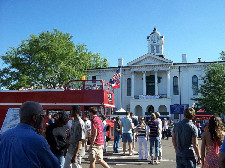
The Square has remained the cultural and economic hub of the city and is home to a variety of shops, boutiques, the south’s oldest department store and a famous independent bookstore. Around the Historic Downtown Square there are restaurants ranging from down-home southern cooking to elegant haute cuisine.

The Circle Historic District is located at the center of the Ole Miss campus with eight academic buildings arranged on University Circle, including the Lyceum Building, Brevard Hall, the Croft Institute for International Studies, the Carrier, Shoemaker, Ventress, Bryant, and Peabody dormitory halls. The district also includes the flagpole, the Confederate Monument, and University Circle.

Paducah Kentucky


trade transportation arts and culture
Paducah is located at the confluence of the Ohio and Tennessee rivers, between St Louis and Nashville. The city is the hub of a micropolitan area comprising Kentucky and Illinois counties. First settled in 1821 and laid out by William Clark of the Lewis and Clark Expedition, it was named Padoucas, the word for Comanche from a Spanish transliteration.
Trade and Transportation
A River and Rail Economy was the key to Paducah’s development as a port, a red brick making factory, a foundry for making rail and locomotive components and dry dock facilities for steamboats and towboats comprised the town infrastructure. Thanks to its proximity to coal fields, Paducah was the home port for barge companies and an important railway hub connecting Chicago with the Gulf of Mexico.

The Paducah-McCraken County River Port Authority provides maritime services for the rural regions of Western Kentucky, Southern Illinois, Southeast Missouri, and Northwestern Tennessee. It specializes in bulk, agricultural and containerized cargoes. The agency specializes in bulk, agricultural, general and containerized cargoes, and operates a Foreign Trade Zone in the only Marine Highway Designation on the Ohio River and the only Marine Highway port on the river that is designated for container service.

Arts and Culture

The National Quilt Museum is a cultural destination that attracts quilters and art enthusiasts to the Paducah area. The museum features professional quilt and fiber art exhibits that are rotated throughout the year and is the largest single tourist attraction in the city.

Paducah is part of the UNESCO Creative Cities Network


The Paducah Wall to Wall program was begun by mural artists on the downtown flood wall in 1996; over 50 murals address subjects ranging from Native American history, river barges, steamboats and local African-American heritage.

Gillette Wyoming


energy capital of the nation

Gillette is centrally located in an area involved with the development of vast quantities of American coal, oil and gas Over the last decade, the population has increased 48 percent. Founded in 1891 with the coming of the Chicago, Burlington & Quincy Railroad, it was named for Edward Gillette, who worked as a surveyor for the company.  


The Rockpile Museum documents life in early Gillette. After the railroad moved to Sheridan, Gillette survived in order to serve the ranchers, cowboys, and homesteaders who were trying to make a life in the countryside surrounding the town. Cattlemen drove their herds into the livestock yards at Gillette for sale and transportation to the markets back east. Industrious citizens set up businesses to cater to these people and any who passed through. Livery barns, stables, and blacksmiths popped up to house travelers’ horses and haulers’ draft teams. Bars and brothels catered to those who pursued that lifestyle.


Tourism Gillette's inclusion on the Black and Yellow Trail in 1912, a highway extending from the Black Hills to Yellowstone, brought many different travelers and tourists into town via automobile resulting in construction of tourist camps, cottages, and motels along with cafes and eateries.

The Gillette Syndrome is named for the social disruptions that occur in towns experiencing rapid growth; during the 1960s, Gillette doubled its population from 3,580 to 7,194 resulting in increased crime, high costs of living and weakened social and community bonds.

Geography Gillette Wyoming is situated between the Bighorn Mountains and the Black Hills in the Powder River Basin. Devils Tower rises 1,267 feet - 386 m - above the Belle Fourche River; the summit is 5,112 feet - 1,559 m - above sea level.

Wabash Indiana


the Wabash and Erie Canal
The name Wabash derives from the Miami-Illinois phrase water over white stones; the Miami name reflected the clarity of the river whose bottom is limestone.  
The Wabash Post Office has been Operating since 1839
The first electrically lighted city in the world was inaugurated on March 31, 1880. The Wabash courthouse grounds were lighted with four 3,000-candle power lamps suspended from the top of the courthouse. Two telegraph wires ran from the lamps to the courthouse basement, where they were connected to a threshing machine to provide power.
Wabash is Home to Several Historic Districts
The Wabash and Erie Canal provided traders with access from the Great Lakes to the Ohio River; 460 miles long, it was the longest canal ever built in North America. The waterway was a combination of four canals: the Miami and Erie, the original Wabash and Erie from Junction to Terre Haute, Indiana, the Cross-Cut Canal from Terre Haute to Point Commerce, and the Central Canal from Worthington to Evansville. 
The Interpretive Center is an open-air village located on the banks of the canal in Delphi, Indiana. The interpretive center includes a model canal with a miniature reservoir, aqueduct, lock, and gristmill. The model canal boat General Grant shows the type of boats that carried freight on the canal during its final years of full-scale operation from the 1860s to 1874.

The Wabash & Erie Canal Association is dedicated to Indiana's Canal Heritage
Travel along the canal was accomplished by canal freight and passenger packets. The passenger packet consisted of a series of rooms and a main saloon where meals were taken. This room was converted into a men's dorm for sleeping. The women’s saloon was towards the back of the boat.
The Packets were Pulled by Horses and Oxen
The Route was from Toledo on Lake Erie to Fort Wayne. From here, it follows the historic Indian portage to the Wabash River, then heads downstream to Delphi and, using several other riverways, it reaches the Ohio River.

Ardmore Oklahoma


business culture and tourism
Ardmore is the hub of a ten-county region known as Lake and Trail Country in South Central Oklahoma located 90 miles - 140 km - from both Oklahoma City and Dallas Forth Worth. It was named after the Philadelphia historic main line town and a town in County Waterford, Ireland.
Ardmore is the word for Hills or High Grounds in Irish
Founded in the summer of 1887 during construction of the Santa Fe Railroad, Ardmore grew over the years into a trading outpost with its cotton growing fields and the world's largest inland cotton port.
Oil Discovery nearby in 1913 led to entrepreneurs and wildcatters flooding the area, becoming the largest oil-producing county in Oklahoma and energy center for the region.
Geography Ardmore is located south of the Arbuckle Mountains, an ancient, eroded range spanning some 62 mi - 100 km - across southern Oklahoma. The geology includes uplifted and folded ridges visible within the shoreline of some of the surrounding lakes. The city of Ardmore is part of the Washita and Red River watersheds, just north of Lake Murray which flows into the western reaches of Lake Texoma.
Transport the historic Santa Fe depot in downtown Ardmore links the town with Chicago, Kansas City, Oklahoma City, Dallas-Fort Worth and DFW Airport via the Heartland Flyer and Trinity Railway Express.
Southern Tech built a state-of-the-art Engineering Technology Building to house programs which directly address the employment needs of manufacturing companies. The Bio Technology Program is a hands-on opportunity to learn and experience biotechnology techniques and applications in human health, agriculture, environmental science, forensics and pharmaceutical production.

Wichita Kansas


trading post industrial hub and regional center of culture media and trade
Wichita lies on the Arkansas River in south-central Kansas, 157 mi (253 km) north of Oklahoma City, 181 mi (291 km) southwest of Kansas City, and 439 mi (707 km) east-southeast of Denver. The Arkansas follows a winding course, south-southeast through Wichita, roughly bisecting the city.
A Trading Post on the Chisholm Trail in the 1860s, it became a destination for cattle drives traveling north from Texas to Kansas railroads, earning it the nickname Cowtown.
Business opportunities attracted area hunters and traders, and a new settlement was organized as the Wichita Town Company, naming the settlement after the Wichita tribe. In the early 20th century, oil and natural gas deposits were discovered nearby triggering an economic boom in Wichita as producers established refineries, fueling stations, and headquarters in the city. Resources generated by the oil boom enabled local entrepreneurs to invest in airplane manufacturing. Except for a slow period in the 1970s, Wichita has continued to grow steadily into the 21st century as the city government and local organizations began collaborating to re-develop downtown Wichita and older neighborhoods in the city.
Neighborhoods include Old Town, a 50-acre area home to nightclubs, bars, restaurants, a movie theater, shops, apartments and condominiums, many of which make use of historical warehouse-type spaces. The two most notable residential areas of Wichita are Riverside and College Hill, along with Delano on the west side of the Arkansas River and Midtown in the north-central part of the city.
The Arts Wichita is a cultural center for Kansas and home to several art museums and performing arts groups. The Wichita Art Museum is the largest art museum in the state of Kansas with 7,000 works in permanent collections and the Ulrich Museum of Art at Wichita State University is a modern and contemporary art museum with over 6,300 works. Small art galleries are scattered around the city with some clustered in the districts of Old Town, Delano and south Commerce street. The music hub of central Kansas draws major acts from around the world, performing at concert halls, arenas and stadiums around the area.
Wichita Transit operates 53 buses on 18 fixed bus routes within the city providing over 2 million trips per year as well as a demand response paratransit service with 320,800 passenger trips annually. Intercity bus services connect Wichita with other Kansas towns, Oklahoma and Colorado. Wichita's Bikeways cover 115 miles of which one third were added between 201 and 2018

Georgetown Texas


victorian architecture economic development energy and the environment
Georgetown is located 30 miles from Austin on the northeastern edge of Texas Hill Country. Portions of the town are located on either side of the Balcones Escarpment, a fault line characterized by black, fertile soils of the Black land Prairie, with the west side consisting of hilly, limestone karst formations.
The North and Middle Forks of the San Gabriel River run through the city, providing over 30 miles of hike and bike trails, parks and recreation for residents and visitors.  

History the earliest known historical occupants of the county, the Tonkawas, were a flint-working, hunting people who followed buffalo on foot and periodically set fire to the prairie to aid them in their hunts. During the 18th century, they made the transition to a horse culture and used firearms. The town was named for George Washington Glasscock who donated the land for the new community; the early American and Swedish pioneers were attracted to the area's abundance of timber and clear water.

Victorian Architecture in 1976, a local ordinance was passed t protect the historic central business district. Georgetown has three National Register Historic Districts: Williamson County Courthouse District, Belford National District and the University Avenue/Elm Street District.

Southwestern University the Oldest University in Texas is 1/2 Mile from the Historic Square
Economic Development Georgetown was an agrarian community for most of the 19th and early 20th centuries. The Shawnee Trail, a cattle trail that led from Texas to the rail centers in Kansas and Missouri, crossed through Georgetown. The establishment of Southwestern University and construction of a railroad contributed to the town's growth and importance. Cotton was the dominant crop in the area between the 1880s and the 1920s.
Population growth and industrial expansion continued modestly in the 20th century until about 1960, when residential, commercial, and industrial development, due to major growth and urban expansion of nearby Austin, greatly accelerated. Currently, Georgetown is served by the appropriately named Georgetown Railroad, a short line railroad that connects with the Union Pacific Railroad at Round Rock and at Granger.
Energy and the Environment in March 2015, Georgetown announced that their municipal-owned utility, Georgetown Utility Systems, would buy 100% of its power for its customers from wind and solar farms, effectively making the city 100% green-powered.